Home Books Earth Science Geospatial Technology Fundamentals and Applications

Geospatial Technology Fundamentals and Applications

Categories

Geospatial Technology Fundamentals and Applications

  • ISBN
  • E-ISBN
  • Book Format
  • Binding
  • Language
  • Edition
  • Imprint
  • ©Year
  • Pages
  • Size (Inch)
  • Weight
  • Book Type
  • Colour Page
Select Format USD( )
Print Book 130.00
Add To Cart Buy Now  Request Complimentary Copy

Blurb

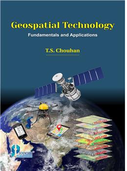
Geospatial technology is a new disciplines integrating various subjects dealing with geographical data. It capture and stores the geospatial data along with spatial and non-spatial information. It includes Surveying, Remote Sensing (RS), Geographical Information System (GIS), Global Positioning System (GPS), Photogrammetry, Cartography, Geography, Computer Science and Statistics. It has emerged as a credible tool in mapping, modeling, monitoring and managing natural resources, environment, natural disasters, and socio-economic features, which are vital components for sustainable development planning and management. The advantage of Satellite Remote Sensing (SRS) and subsequent development of Global Positioning System (GPS) and Geographical Information System (GIS) have made significant changes in surveying and map making.

In the light of this, both in the academia and the industry, these topics have been brought together under one umbrella in term of Geospatial technology. This book will be invaluable for students pursuing various courses on Geospatial technology, Environment studies, Geology, Geography, Disaster, Agriculture, Forestry, Engineering, Marine Science, Urban planning and Socio-economic development. It will prove useful and handy for professionals pursuing Remote Sensing, GPS, GIS and socio-economic development. The entire book has been divided into 16 chapters with Practical Exercises, Short Questions and Multiple Choice Questions.


© 2024 SCIENTIFIC PUBLISHERS | All rights reserved.