Select | Format | INR(₹) |
---|---|---|
Print Book | 275.00 |
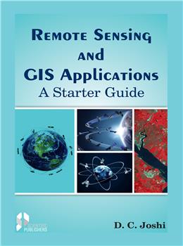
The Satellite Remote Sensing and GIS, a new fast developing technology, has potential for quick and accurate assessment and characterization of natural resources potentials. Nowadays, for any small query, planning and management of natural resources, one can nd quick answer by referring the satellite images. But, satellite images have to be interpreted which requires training and skill. During recent years, at many Universities, at graduate and post graduate degree courses of engineering, agriculture, forestry, geology, geography and environmental sciences, Remote sensing and Geographical Information System (GIS) has been added as a part of syllabus. Keeping in mind, this book has been written, in simple explanatory language with illustrations, so that even novice and inexperienced person can understand and interpret the satellite images. There are 19 chapters in the book, covering two aspects, (1) Fundamentals of Remote Sensing Technology which includes satellites and sensors, spectral reectance characteristics of objects on earth surface, satellite image interpretation techniques and GIS, and (2) Applications of the Technology for identication, mapping and monitoring of landforms, soil, surface and ground water and forest resources; land use/ land cover classication and wasteland mapping; land degradation and desertication classication and mapping; crop identication and acreage estimation, watershed development planning and monitoring; natural calamities and disaster management. Each topic has been elaborately explained with case studies to meet the requirement of the students, teachers, and natural resource planners.
1. Eye in the Sky
2. The Space, Earth and Atmosphere
Constituents of atmosphere
Layers of atmosphere
3. Solar Electromagnetic Radiation
Solar electromagnetic radiation
Electromagnetic radiation used in remote sensing
Black body emission
Interaction of electromagnetic radiation with atmosphere
Atmospheric windows
Interaction of electromagnetic radiation with objects on earth surface
Atmospheric windows
4. Spectral Reflectance Characteristics of objects on Earth Surface
Spectral signature of vegetation, water bodies, soil and land surface
Methods of obtaining spectral reflectance
Laboratory measurement
Ground based in situ measurement
Airborne based measurement
Space borne measurement
Hyperspectral reflectance
5. Aerial Photographs and their Interpretation
Factors affecting quality of aerial photographs
Characteristics of aerial photographs
Stereo or three dimensional image
Aerial photo mosaic
Basic elements of aerial photo-interpretation
Visual interpretation of aerial photographs
Characteristic image of vegetation, soils and water bodies on Aerial
Photographs
Methodology of aerial photo-interpretation for natural resource
Mapping
Advantages of Aerial Photographs
Limitations of Aerial Photographs
6. Satellite and sensors
Earth resources satellite
Sensors
Scanning of ground features
Whisk broom scanner
Push broom scanner
Classification of sensor systems
Landsat Series satellites
Sensors employed on Landsat satellites
Multi-spectral Scanner (MSS)
Thematic mapper (TM)
Indian Resource Satellites
Indian Remote Sensing (IRS) Satellite series
Sensors employed on IRS series Satellite
Linear Imaging Self Scanning (LISS)
Indian Remote Sensing (IRS) satellites
Thermal Infrared Sensor
Microwave Sensor
Parameters of the target material
Side Looking Airborne Radar
Unique capabilities of microwave sensors
Other earth resources satellite
Telecommunication and Meteorological Satellites
INSAT system satellite
7. Satellite Data and their interpretation techniques
Satellite Data
False Colour Composites (FCCs)
Satellite image interpretation
Visual interpretations
Visual interpretation of paper prints
On screen visual interpretation of images
Digital image interpretation
Image processing
Image Enhancement
Contrast enhancement
Band rationing
Normalization Difference Vegetation Index (NDVI)
Principal Component Analysis
Filtering
Density slicing
Image classification
Supervized classification
Unsupervized classification
Ground truth
8. Geographical Information System (GIS)
Elements of Map
Survey of India topographic maps
Information available on SOI maps
Geographical Information System
Components of GIS
Functions performed by GIS
GIS data: spatial data and attribute data
Data input methods
Format for data input
Vector format
Raster format
Components of geographic data
Geo-Referencing
Database management system
Relational data base system
The GIS output
Advantages of GIS
Remote sensing applications
9. Landform Classification and Mapping
Landform mapping with aerial photographs
Landform Mapping with satellite images
10. Soil Resources Classification and Mapping
Soil series: Basic mapping and classification unit
Land capability classification
Soil resource mapping
Semi detailed soil mapping
Detailed soil mapping
Soil resource mapping with Remote Sensing
Soil resource mapping with Aerial Photographs
Soil resource mapping with Satellite Images
Small scale soil mapping with Landsat MSS data
IRS -1A/1B LISS I FCC data for small scale soil mapping
IRS LISS II FCC data soil mapping
IRS-1D LISS III images for physiography- soil relationship study
IRS-1D-LISS III images for soil mapping in complex geological formations
IRS-ID, LISS III images for soil resources mapping in hilly and densely covered forest area
IRS ID LISS-III images for detailed soil survey of micro watershed
IRS P6 LISS III images for physiography -soil resource mapping of watershed
IRS LISS III FCC for identification of soil resources constraints
Soil Resource Information System
Standardization of data base
NRIS code for soil series
Soil data files system
Identification and mapping salt affected Soil
Mapping salt affected soils with aerial photographs
Mapping salt affected soils with Landsat images
Landsat and IRS images for recognition of kind of salt affected soils
Visual Discrimination of surface features of natural salt affected soils
11. Water Resources Appraisal and Management
Surface water resources
Identification and delineation of water bodies
Monitoring reservoir sedimentation
Rainfall-runoff modelling
Potential sites for surface water harvesting
Groundwater
Groundwater potential areas
Groundwater recharge
Potential sites for groundwater recharge structures
Hydrogeomorphological mapping
Identification of Palaeochannels
12. Forest Resources Monitoring and Management
Forest mapping and monitoring
Delineating boundaries of forest blocks and sanctuaries
High potential forest fire area mapping
Carbon sequestration in Forests
13. Land use/ Land cover Classification and Wasteland Mapping
National Land use/ land cover classification and mapping
Monitoring landuse/ land cover changes
Monitoring land reclamation
Urban sprawl
Wastelands Mapping
14. Integration of Natural Resources
Major Land Resources Unit (MLRU)
Integrated Mission for Sustainable Development (IMSD)
Integration of natural resources in GIS environment
Resource Management Domains (RMDs)
15. Crop acreage and Yield estimation
Assessment of disease and insect infestation
Mapping of orchards
16. Watershed Development Planning and Impact Assessment
Selection of sites for water harvesting structures
Watershed development planning
Impact assessment of watershed development
Indicators for impact assessment
Methodology for impact assessment
Impact assessment of integrated watershed development
17. Command Area Monitoring and Management
Waterlogged and saline area in command of irrigation projects
IGNP command area in Rajasthan
Mahanadi command area in Odisha
18. Land degradation and Desertification
Land degradation processes, type and severity
Satellite images for land degradation mapping
Landsat TM image for land degradation mapping
Soil degradation mapping with IRS-1A FCC
Land degradation mapping at National level
Desertification mapping
Desertification and land degradation Atlas of India
Desertification/land degradation mapping under UNCCD programme
19. Natural Calamities and Disaster Mapping
Floods
Flood affected Area Mapping
Flood Damage Assessment
Droughts – Monitoring and assessment
Drought indices
References
SCIENTIFIC PUBLISHERS
"Granthlok"
5-A,New Pali Road,
Bhagat Ki Kothi (Nr. Police Station)
P. O. Box 91, Jodhpur - 342001 (Rajasthan), INDIA
Books +91-9929272222
Journals +91-9829989666
Tel. :+91-2912433323
Email. info@scientificpub.com
Web. www.scientificpubonline.com
DELHI BRANCH
"Granthlok"
4806/24, Ansari Road,
Bharat Ram Road,
Darya Ganj
New Delhi 110002
INDIA
Mob. : +91-95211 31111
Tel. +91-11-47590696
Email. scientificpubdelhi@gmail.com
Make sure you dont miss interesting happenings
by joining our newsletter program
Government e Marketplace (GeM) is a 100 percent Government owned & National Public Procurement Portal.GeM is dedicated e market for different goods.
© 2025 SCIENTIFIC PUBLISHERS | All rights reserved.